
Map quizzes / Caribbean Map
Caribbean Map
The Caribbean has 13 island countries, from the Bahamas and Cuba to Barbados and Trinidad and Tobago, plus territories such as Puerto Rico. Here they are on a labeled map; the quiz below asks for the biggest islands.
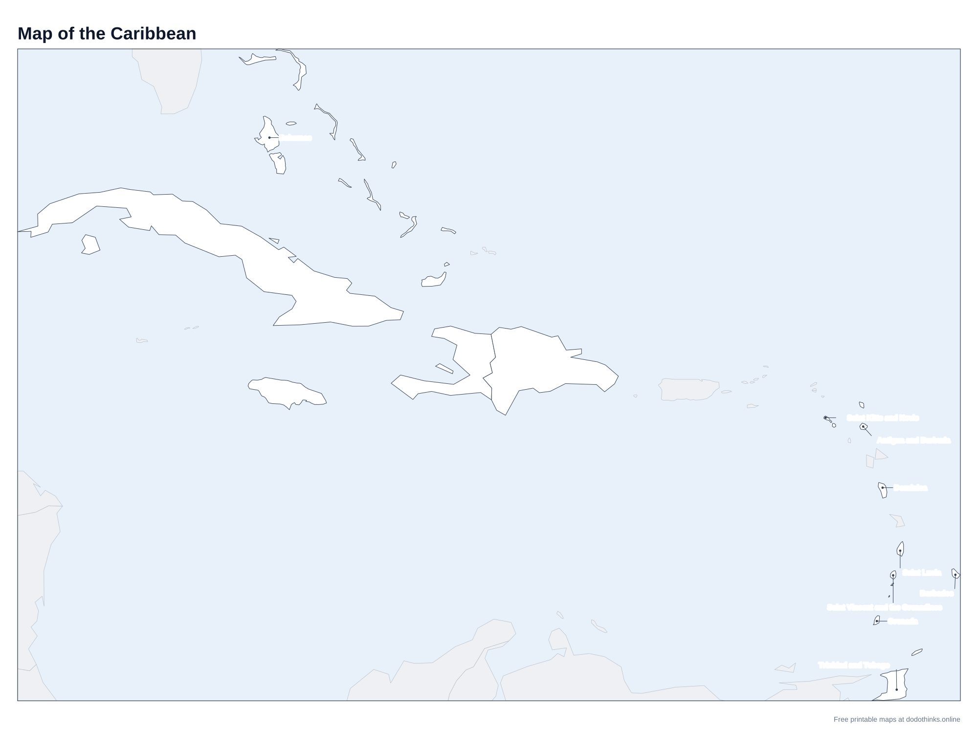
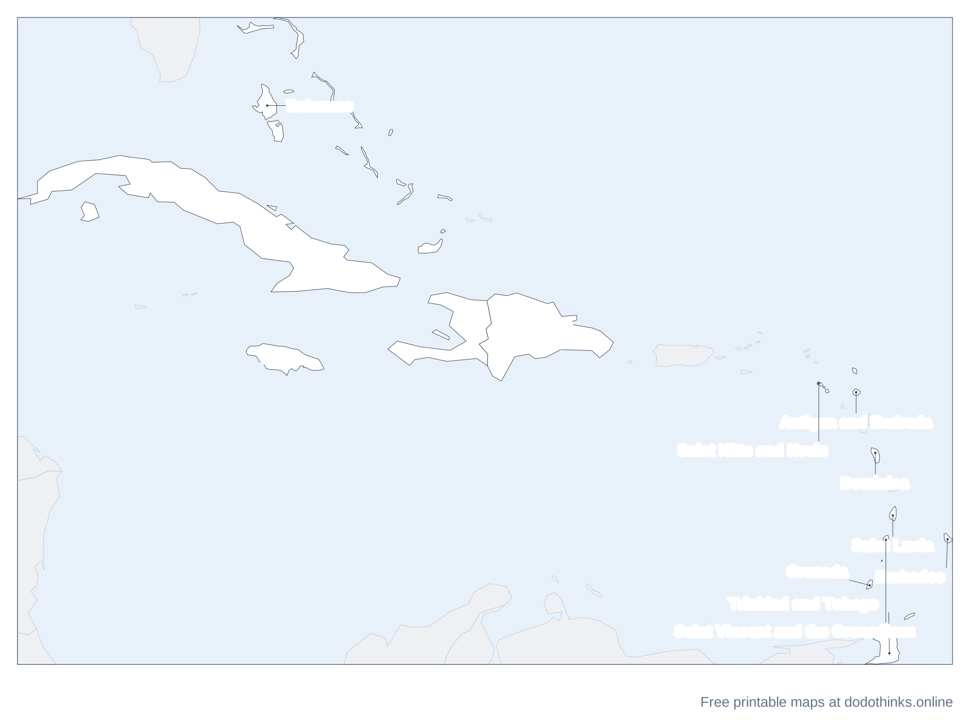
The Caribbean is a chain of island nations arcing between North and South America. This interactive quiz covers the largest islands — from Cuba and Hispaniola to Jamaica and the Bahamas — and names each one for you to click.
Caribbean Map Quiz at a Glance
The Caribbean Map Quiz is a free map game from DodoThinks. A place is named and you click it on the map, 10 questions a round, across three difficulty levels. There are 7 places to learn, and it runs in any browser with no sign-up.
- Places to find
- 7
- Each round
- 10 questions
- Time limit
- None
- How you answer
- Click the map
- Levels
- Easy, Difficult and So Difficult
- Cost
- Free, no sign-up
Learn the Caribbean by Group
The Caribbean islands fall into a few clear groups:
The Greater Antilles — the big islands running west to east: Cuba (the largest), Hispaniola (shared by Haiti in the west and the Dominican Republic in the east), Jamaica to the south, and Puerto Rico to the east.
The Bahamas — the archipelago north of Cuba, arcing toward Florida.
The Lesser Antilles — the small chain curving south toward South America, ending at Trinidad and Tobago off the coast of Venezuela. Many of these islands are too small to show at map scale.
Why the Caribbean Map Is Tricky
The Caribbean packs many nations into a small area, and most are tiny islands — which makes it one of the hardest regions on any world map.
This quiz focuses on the larger islands you can reliably click: Cuba, Haiti, the Dominican Republic, Jamaica, the Bahamas, Puerto Rico, and Trinidad and Tobago. For the smaller nations of the Lesser Antilles — and every Caribbean capital — the capitals quizzes are the better drill.
The Caribbean is dominated by the Greater Antilles — Cuba, Hispaniola (shared by Haiti and the Dominican Republic), Jamaica, and Puerto Rico — plus the Bahamas to the north and Trinidad and Tobago to the south. Cuba is the largest island by far, and the many small nations of the Lesser Antilles are the hardest to place.
Quiz tip: The Greater Antilles — Cuba, Hispaniola, Jamaica, and Puerto Rico — are the big, easy anchors; the smaller Lesser Antilles are mostly too tiny to render at map scale.
Largest island
Cuba
Shared island
Hispaniola (Haiti + DR)
Anchors
Cuba, Hispaniola, Jamaica
To the south
Trinidad & Tobago
Note
Small isles too tiny to map
The 6 Countries on the Caribbean Map and Their Capitals
A to Z. Tap a country for its flag, population and facts.
 BahamasNassau
 CubaHavana
 Dominican RepublicSanto Domingo
 HaitiPort-au-Prince
 JamaicaKingston
 Trinidad and TobagoPort of Spain
Also on the map, but not a UN member: Puerto Rico (San Juan).
Frequently Asked Questions
How many countries are in the Caribbean?
The Caribbean has 13 sovereign island nations, plus several territories. Many are very small; this map quiz focuses on the larger islands that render clearly at scale.
What is the largest island in the Caribbean?
Cuba is the largest island in the Caribbean by far, followed by Hispaniola — which is shared by Haiti and the Dominican Republic.
Which Caribbean islands are hardest to locate?
The small nations of the Lesser Antilles are the hardest — most are too tiny to render at map scale. The Greater Antilles (Cuba, Hispaniola, Jamaica, Puerto Rico) are the easy anchors.
What is the easiest way to learn the Caribbean map?
Start with the Greater Antilles from west to east — Cuba, Hispaniola, Jamaica, Puerto Rico — then add the Bahamas to the north and Trinidad and Tobago to the south.
Is the Caribbean map quiz free?
Yes — it runs free in your browser with no download or signup. Sign in with Google to save your score.
Made by Kashif Sulehria in Lahore, Pakistan. Updated .