
Africa Map Quiz: The Countries Players Miss Most
October 26, 2026 · 4 min read
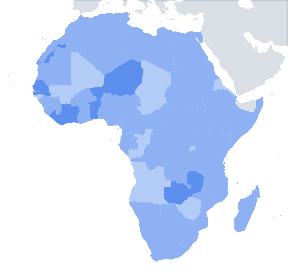
Africa is the hardest continent on DodoThinks. On our Africa map quiz, a country is named and you click it on a blank map. Across 1,166 answers, players got only 49% right. On the Europe map the same game scores 73%.
That is not because Africa is obscure. It is because Africa has 54 countries, more than any other continent, and many of them are small and packed together in West and Central Africa.
The hardest countries to find
These are the lowest scores, counting countries asked at least 14 times.
| Country | Found |
|---|---|
| Equatorial Guinea | 19% |
| The Gambia | 21% |
| Uganda | 25% |
| Liberia | 25% |
| Rwanda | 27% |
| Eswatini | 30% |
| Guinea | 33% |
| Comoros | 33% |
| Benin | 35% |
| Botswana | 35% |
| Mauritius | 36% |
| Cape Verde | 38% |
The easiest
Morocco and South Africa (86% each) and Madagascar (85%) are the easiest. All three sit at the edges of the continent with shapes that are easy to spot. Tunisia (79%) and Nigeria (77%) follow.
What people click instead
| Asked for | Clicked instead | Times |
|---|---|---|
| Central African Republic | DR Congo | 8 |
| Benin | Togo | 7 |
| Benin | Ghana | 7 |
| Benin | DR Congo | 4 |
| Benin | Nigeria | 4 |
| Zambia | Zimbabwe | 4 |
| Sudan | DR Congo | 4 |
| Botswana | Zimbabwe | 3 |
| Republic of the Congo | DR Congo | 3 |
Benin, Togo and Ghana
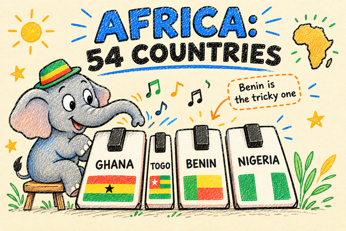
Benin was asked 60 times and missed 39 times, and most wrong clicks landed on the countries around it: Togo, Ghana and Nigeria. These are thin countries that run north from the coast of the Gulf of Guinea, side by side like piano keys. From west to east the order is Ghana, Togo, Benin, Nigeria. Togo is the thinnest. Benin is a bit wider, and Nigeria is the big one.
The two Congos and the middle of Africa
DR Congo is the second-largest country in Africa, and it acts like a magnet for wrong clicks: players looking for the Central African Republic, Sudan and the Republic of the Congo all clicked it. The rule to remember: the Republic of the Congo is the smaller one, west of the Congo River. DR Congo is the huge one to its east and south. The Central African Republic sits just north of both.
Zambia, Zimbabwe and Botswana
These three meet near Victoria Falls, and players mix them up often. Zambia is the larger, odd-shaped one to the north. Zimbabwe is south of it, a compact country without a coast. Botswana is west of Zimbabwe and directly north of South Africa.
Why the small ones are so hard
The Gambia is a thin strip of land along the Gambia River, surrounded on three sides by Senegal. Equatorial Guinea is a small square on the coast below Cameroon, plus the island of Bioko. Rwanda and Uganda sit in the Great Lakes region, next to bigger countries like Kenya, Tanzania and DR Congo. Eswatini is a small kingdom between South Africa and Mozambique.
And the island countries (Comoros, Mauritius, Cape Verde) are tiny dots in the ocean. If you do not know where to look, you will not find them by scanning the coast.
A better way to learn all 54
- Start with the big frame. Algeria, Libya, Egypt, Sudan, DR Congo, South Africa, Ethiopia, Nigeria. These anchor the map.
- Then the coastlines. Go around the coast from Morocco clockwise, the way a ship would. Most African countries touch the sea, so this covers a lot.
- Then the West African coast, in order. Guinea-Bissau, Guinea, Sierra Leone, Liberia, Côte d'Ivoire, Ghana, Togo, Benin, Nigeria.
- Then the Great Lakes. Uganda, Rwanda, Burundi, sitting around Lake Victoria and Lake Tanganyika.
- The islands last. Cape Verde off Senegal, São Tomé off Gabon, Comoros between Mozambique and Madagascar, Mauritius and Seychelles further out in the Indian Ocean.
Then play the Africa map quiz and see how many you get. The page also lists every country with its capital, and our Flags of Africa quiz is a good next step.
About this data
These are 1,166 answers on the DodoThinks Africa map between 24 September and 26 October 2026. Because the map has 54 countries, each one has been asked fewer times than on smaller maps, so treat single percentages as a guide rather than an exact score. The patterns, especially around Benin and the Congos, are clear.