
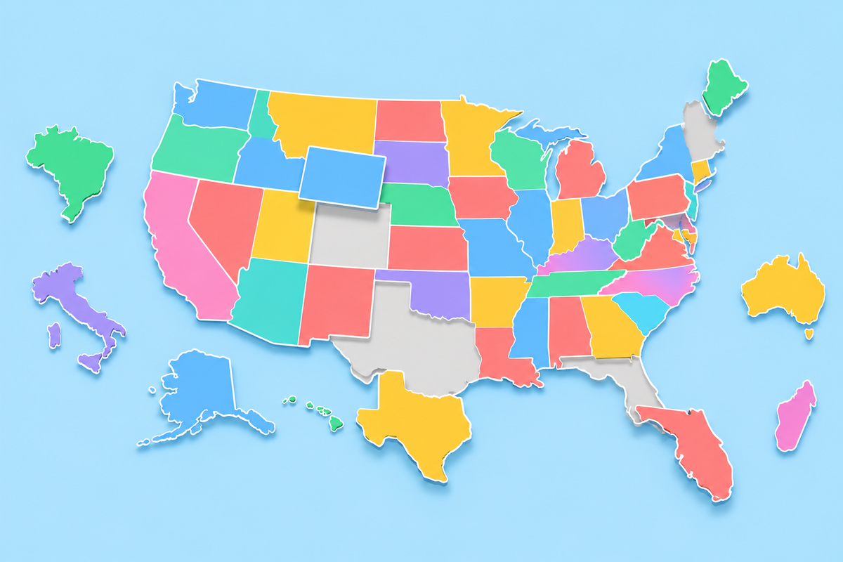
US and World Map Puzzles: How to Solve Them Fast
November 3, 2026 · 5 min read
The first jigsaw puzzles were maps. In the 1760s, John Spilsbury, a London engraver and mapmaker, glued maps onto thin wood and cut them apart along the borders. He sold these "dissected maps" to help children learn geography, and he is usually credited as the first person to make jigsaw puzzles to sell. The name "jigsaw puzzle" only came into use in the early 1900s.
The idea still works, so we built two of them: the US Map Puzzle and the World Map Puzzle. The map is empty, the pieces wait in a tray, and you drag each one to its place, where it snaps in. Both are free and work on a phone.
Here is how to finish them fast, and the places where almost everyone slips.
The short version:
- Build the frame first: the corners and the coasts.
- Place the biggest pieces next. They give the small ones something to lean on.
- Leave the crowded corners for last, when only a few holes are left.
- Learn the look-alike pairs before you try Hard.
Why a puzzle teaches a map
A map quiz asks you to find one place at a time. A puzzle makes you deal with three things at once: the shape of each piece, the pieces around it, and where it sits on the whole map. You cannot place Kentucky without noticing Tennessee below it and Ohio across the river to the north.
Mistakes teach you too. When you drop a piece in the wrong hole, the game tells you whose place you tried: "That's where Missouri goes." Now you know two places, not one. After three misses with the same piece, its place lights up, so nobody stays stuck for long.
How to solve the US map puzzle
Step 1: The corners
Start with the states at the edges of the map: Washington in the top left, California down the west coast, Texas at the bottom, Florida in the bottom right and Maine in the top right. Alaska and Hawaii go in their boxes in the bottom left, so put them in early too.
Step 2: The big blocks of the West
The western states are big, and many of them are close to rectangles. Montana runs along the Canadian border. Below it, Wyoming and Colorado are two near-perfect boxes, with Wyoming on top. Utah, Colorado, Arizona and New Mexico meet at the Four Corners, the only point in the country where four states touch. Once those four are in, the rest of the West falls into place.
Step 3: Follow the Mississippi
The Mississippi River runs from Minnesota down to Louisiana, and it forms many state borders on the way. Ten states touch it: Minnesota, Wisconsin, Iowa, Illinois, Missouri, Kentucky, Tennessee, Arkansas, Mississippi and Louisiana. Build down the river on both sides and the middle of the country is done.
Step 4: The Northeast last
New England and the Mid-Atlantic are where the small states live. Rhode Island and Delaware are only a few pixels wide on a phone, so on Easy a dashed ring marks their place. You don't need to hit them exactly: a piece snaps in once it is close.
One more tip: Michigan is a single piece in two parts, the mitten and the Upper Peninsula above it. Drop it so both parts line up with the Great Lakes.
The pairs that catch everyone
These are the pieces people swap most, especially on Hard, where the names are gone and every piece starts turned.
- Vermont and New Hampshire. Two wedges, one upside down. Vermont is wide at the top and has no coast; New Hampshire is wide at the bottom and has a short stretch of Atlantic shore.
- North and South Dakota. Nearly the same box. North Dakota is the one that touches Canada.
- Wyoming and Colorado. Two rectangles of similar size. Wyoming is the northern one; Colorado touches New Mexico.
- Mississippi and Alabama. They look like mirror images. Mississippi is the one on the river.
The World Map Puzzle
The world puzzle has four boards, from a quick start to a real challenge.
The continents. Six big pieces: Africa, Asia, Europe, North America, South America and Oceania. It takes about a minute and suits younger players. Russia is drawn as part of Europe, as it is in the rest of our games.
South America. Twelve countries and the Falkland Islands. Start with Brazil: it borders every country on the continent except Chile and Ecuador, so it is the frame for everything else. Chile is the long strip down the west side. Paraguay and Uruguay are the pair people swap: Paraguay is landlocked in the middle, and Uruguay sits on the coast between Brazil and Argentina.
Africa. All 54 countries plus Western Sahara. Place the giants first: Algeria, the largest country in Africa, then the Democratic Republic of the Congo in the middle and South Africa at the bottom. Two pieces almost solve themselves: Lesotho sits entirely inside South Africa, and The Gambia is a thin strip pushed into Senegal. Leave the West African coast for late. Guinea-Bissau, Guinea, Sierra Leone, Liberia, Côte d'Ivoire, Ghana, Togo and Benin line up one after another. The island nations, from Cape Verde to the Seychelles, get dashed rings on Easy.
Europe. 38 countries. Russia and Turkey are drawn in grey around the edges, and the six microstates, such as Monaco and Vatican City, are too small to be pieces. Begin with Ukraine, France and Spain, the three biggest pieces. Then build the Nordic countries across the top and leave the Balkans for last: Croatia, Bosnia and Herzegovina, Serbia, Montenegro, Albania and North Macedonia all fit into one small corner. The Baltic states are three similar pieces stacked from north to south: Estonia, Latvia, Lithuania.
Easy or Hard?
Easy shows the borders on the empty map and the names on the pieces, so you learn while you play. Hard shows only the outline of the whole map, the pieces have no names, and every piece starts turned. Tap a piece to turn it a quarter, then drag it in. A piece in the right place but turned the wrong way does not fit.
There is no clock while you play, so take your time. Your score is how many pieces went in on the first try, and when the map is done you see how long it took, along with your best time on that device.
For teachers
Both puzzles work as a class challenge. Set one up from the Teachers page and every pupil gets the same tray, with the pieces in the same order, so the scores on the class board are fair. The continents or South America on Easy make a quick warm-up at the start of a lesson.
Try it
Start with the US Map Puzzle on Easy, then switch to Hard once you can finish without the names. When the states feel easy, move on to the World Map Puzzle and work up from the continents to Europe. To drill the trickiest places first, the US States Map quiz and US State Shapes make good warm-ups.