
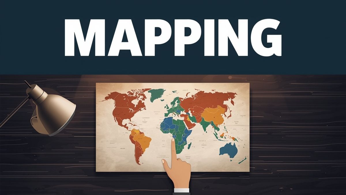
Mapping the Seven Continents: A Practical Guide to the World Map
September 15, 2026 · 15 min read · updated September 15, 2026
Mapping the Seven Continents: A Practical Guide to the World Map
Earth's surface is dominated by water, with land making up less than a third of the total area. If you feel overwhelmed trying to memorize every corner of that space, you aren't alone. Most people can name the big landmasses, but they trip up when it comes to the exact borders of the Caucasus mountains or the difference between a continent and a tectonic plate. DodoThinks, a free educational geography platform where you can play interactive quiz games to master these maps, was built to turn that confusion into a fast, mental reflex.
I've spent months testing every game mode on DodoThinks to see how people actually learn these borders, and the results are clear. Learning the world map isn't about staring at a static poster until your eyes glaze over. It's about breaking the globe into manageable pieces and understanding the stories behind the lines. Whether you're a student prepping for an exam or a traveler wanting to know exactly where you're headed, understanding the continents is your first step toward global literacy.
You'll get a clear breakdown of the seven-continent model, a look at the "lost" landmasses hiding under the ocean, and a glimpse into how the map will shift in the distant future. We'll also cover the specific continent that holds exactly 12 sovereign countries and give you a 7-day plan to memorize the whole thing.
The standard model of the seven continents
There are seven continents in the world map: Africa, Antarctica, Asia, Australia (often called Oceania), Europe, North America, and South America. While different cultures sometimes use a five or six-continent model, the seven-continent version is the most widely taught standard in English-speaking schools and international organizations. This model relies on a combination of tectonic plates and traditional geographic boundaries that have been established over centuries of exploration and cartography.
Asia stands as the largest of the group, both in terms of land area and human population, housing the majority of the world's people. Because it's so massive, its borders can be tricky. To the east, it's bounded by the Pacific Ocean, and to the south, the Indian Ocean. The western border is where things get interesting (and where many geography students lose points on quizzes). The Ural Mountains, the Caspian Sea, and the Caucasus Mountains form the traditional dividing line between Asia and Europe. This boundary is more of a cultural and historical convention than a strict geological separation, as both continents sit on the same massive tectonic plate.
Africa is the second-largest continent and is often described as the most centrally located landmass. It's the only continent to be crossed by both the Prime Meridian and the Equator. According to the United Nations list of member states, Africa contains 54 sovereign countries, which is more than any other continent. If you're using DodoThinks to practice, the African flag games are usually the most challenging because of the sheer number of distinct nations you have to recognize, ranging from the Mediterranean coast in the north to the Cape of Good Hope in the south.
North America and South America are often grouped as "The Americas," but they sit on distinct tectonic plates and have very different geographical profiles. North America stretches from the icy reaches of northern Canada and Greenland down to the tropical forests of Panama. It includes the massive landmasses of the United States and Canada, along with the diverse nations of Central America and the Caribbean. South America starts just below the Isthmus of Panama and runs all the way to the tip of Cape Horn, dominated by the Amazon River basin and the towering Andes Mountains.
Europe is technically a massive peninsula of the larger Eurasian landmass, but it's treated as a separate continent for historical and cultural reasons. It's the second-smallest continent by area but remains one of the most densely populated and politically influential. The continent is defined by its deeply indented coastline, featuring numerous peninsulas like the Iberian, Italian, and Balkan peninsulas, which have historically encouraged maritime trade and cultural exchange.
Australia is the smallest continent and is unique because it's also a single country, though in a broader geographical sense, it's part of Oceania, which includes thousands of islands across the Central and South Pacific. This region includes Melanesia, Micronesia, and Polynesia, making it one of the most geographically spread-out areas on the map. Finally, there's Antarctica. It's the coldest, driest, and windiest place on Earth, with no permanent human residents, only seasonal researchers. It is almost entirely covered by an ice sheet that contains the majority of the world's fresh water.
The continent with exactly 12 countries
South America is the continent that only has 12 sovereign countries. These nations are Argentina, Bolivia, Brazil, Chile, Colombia, Ecuador, Guyana, Paraguay, Peru, Suriname, Uruguay, and Venezuela. This relatively small number of nations makes it one of the best places for geography students to start when they want to move beyond the most famous global powers.
Many people mistakenly count French Guiana as a 13th country, but it's actually an overseas department of France. It uses the Euro and is governed from Paris, even though it sits on the northern coast of the South American continent. You might also hear about the Falkland Islands, but these are a British Overseas Territory. These geopolitical nuances are exactly the kind of details that trip up casual learners but become second nature once you start practicing with interactive maps.
When you're studying the South American map, it helps to group the countries by their geography. You have the "Andean States" like Peru and Chile that are defined by the massive mountain range running down the west coast. Then you have the "Southern Cone" countries like Argentina and Uruguay, known for their temperate climates and vast plains. Brazil is the giant of the continent, taking up nearly half of the land area and bordering almost every other nation there. Suriname and Guyana, located on the northern coast, often feel culturally distinct from their Spanish and Portuguese-speaking neighbors due to their Dutch and British colonial histories.
| Continent | Approximate Population | Number of Countries | Highest Point |
|---|---|---|---|
| Asia | 4.7 Billion | 48 | Mt. Everest |
| Africa | 1.4 Billion | 54 | Mt. Kilimanjaro |
| Europe | 740 Million | 50 | Mt. Elbrus |
| North America | 600 Million | 23 | Denali |
| South America | 430 Million | 12 | Aconcagua |
| Australia | 43 Million | 14 (Oceania) | Mt. Kosciuszko |
| Antarctica | 0 (Permanent) | 0 | Vinson Massif |
The population data in this table is based on estimates from the World Bank Open Data, which tracks global demographic trends. These figures highlight the massive disparity in population density across the continents, with Asia housing more people than the rest of the world combined.
The mystery of the two lost continents
The two lost continents are Zealandia and Mauritia, both of which are almost entirely submerged beneath the ocean. These aren't myths like Atlantis; they're geological realities that scientists have mapped using satellite data and sea-floor samples. They represent fragments of older supercontinents that were left behind as the Earth's crust shifted and pulled apart.
Zealandia is a massive chunk of continental crust located east of Australia. According to research published by the Geological Society of America, about 94 percent of it is underwater. The parts that actually poke above the waves are New Zealand and New Caledonia. In 2017, geologists officially argued that Zealandia should be considered Earth's eighth continent because it's made of thick, continental crust (covering about 1.9 million square miles) rather than the thinner oceanic crust that makes up the rest of the sea floor.
Mauritia is a much smaller "micro-continent" that used to sit between India and Madagascar. It disappeared about 84 million years ago as the Indian Ocean began to form and the tectonic plates pulled apart. Scientists found evidence of it by discovering ancient zircon crystals on the beaches of Mauritius that were billions of years old, far older than the volcanic island itself. This suggested that a much older piece of continental crust was melting deep beneath the ocean floor, leaving behind chemical signatures in the newer volcanic rock.
How the world map will look in 100 million years
In 100 million years, Earth will look unrecognizable because the continents are constantly moving at about the same speed your fingernails grow. Scientists predict that the Atlantic Ocean will likely close or the Pacific will shrink, eventually pulling all the landmasses back together into a new supercontinent often called Pangea Proxima or Amasia. This movement is part of a grand cycle that has repeated throughout Earth's four-billion-year history.
Tectonic plates are driven by heat from deep within the planet, a process that keeps the world map in a state of constant, slow-motion change. Currently, Africa is slowly moving toward Europe. In the distant future, the Mediterranean Sea will likely vanish, replaced by a massive mountain range similar to the Himalayas. Australia is also drifting north at a relatively fast pace, meaning it could eventually collide with Southeast Asia, merging the two regions into a single landmass.
By the 100-million-year mark, the Americas will have shifted significantly. Some models suggest they will move westward and merge with Asia, while others suggest they will stay connected to a closing Atlantic. This process of continents breaking apart and coming back together is known as the Wilson Cycle, and it has happened several times in Earth's history, with Pangea being the most famous example from about 300 million years ago. These changes remind us that the borders we study today are merely a snapshot in geological time.
Identifying continents by their shapes
One of the best ways to get fast at geography is to stop looking at the names and start looking at the outlines. Every continent has a "silhouette" that makes it instantly recognizable if you know what to look for. Visual mnemonics can help you identify these shapes in a split second, which is essential for competitive geography games.
Africa is often described as looking like a giant rhinoceros head or a lopsided heart. It has a very smooth coastline compared to Europe, which is jagged and full of peninsulas. When you're playing the "Country Shapes" game on DodoThinks, you'll notice that African borders are often straight lines (a result of colonial history), while European borders follow rivers and mountain ranges. Look for the "Horn of Africa" on the eastern side, which points toward the Arabian Peninsula.
South America looks like a triangle or a "V." It's very easy to distinguish from North America because it lacks the massive islands and jagged bays of the north. North America is much more chaotic, with the huge mass of Greenland to the northeast, the archipelago of northern Canada, and the narrow tail of Central America. You can recognize North America by the "beak" of Alaska in the northwest and the "thumb" of Florida in the southeast.
Asia is the most complex shape to learn because of its size. It has three major southern peninsulas: the Arabian Peninsula, the Indian subcontinent, and the Indochinese Peninsula. Australia is the most isolated-looking shape. It's thick and compact, with the distinct "bite" of the Great Australian Bight at the bottom. Antarctica is roughly circular but has the long Antarctic Peninsula reaching out toward South America like a finger pointing north.
A 7-day plan to master the world map
If you want to move from "I know the basics" to "I can point to any country on a map," you need a structured approach. Staring at a map for five hours once a month won't work. You need short, high-intensity bursts of practice. This plan is designed to build your knowledge layer by layer, starting with the largest features and moving toward the smallest details.
Day 1: The Big Seven. Focus only on the continents and the major oceans. Don't worry about countries yet. Just make sure you can identify the borders between Europe and Asia and the Isthmus of Panama. Use the Pacific, Atlantic, Indian, Arctic, and Southern oceans as your primary landmarks.
Day 2: The Americas. Spend 15 minutes on North and South America. Learn the 12 countries of the south first because they're easier to memorize. Then move to the 23 countries of the north. Pay attention to the "bridge" of Central America, including nations like Guatemala, Costa Rica, and Panama.
Day 3: Africa. This is the hardest day. Break it into regions: North Africa, West Africa, East Africa, and Southern Africa. Don't try to learn all 54 at once. Focus on the large nations like Algeria, Nigeria, and Ethiopia first, then fill in the smaller coastal countries.
Day 4: Europe. Focus on the "big players" first (France, Germany, Spain, UK, Italy) and then move to the Balkan states and Eastern Europe. Try to visualize the "boot" of Italy and the "square" of the Iberian Peninsula to keep your bearings.
Day 5: Asia. Focus on the giant nations (China, India, Russia) and then the distinct regions like Southeast Asia and the Middle East. Asia is home to many "stans" (Kazakhstan, Uzbekistan, etc.), so spend extra time distinguishing them in Central Asia.
Day 6: Oceania and Islands. Learn the 14 nations of Oceania and the major island chains. This includes Australia, New Zealand, and Papua New Guinea, as well as smaller island nations like Fiji and Samoa.
Day 7: The Speed Test. This is where you put it all together. Use a timer. Give yourself 10 minutes to name as many countries as possible. This is the best way to identify which regions still cause you to hesitate.
The 9-second drill for geographic memory
The secret to long-term memory isn't just repetition; it's "recall under pressure." When you have all the time in the world, your brain gets lazy. When you're on a timer, your brain is forced to build stronger neural pathways. This is the core philosophy behind the DodoThinks platform, where we use rapid-fire rounds to sharpen your mental map.
At DodoThinks, our games use a 9-second timer per question for a reason. It's just enough time to think, but not enough time to second-guess yourself. You can replicate this at home even without the app by using flashcards or a digital timer.
- Pick a continent (let's say South America).
- Have a friend name a country or show you a shape.
- You have exactly 9 seconds to name the capital or point to its location.
- If you miss it, write it down. Those "misses" are your only study list for the next day.
This method is far more effective than reading a list of facts because it identifies the specific gaps in your knowledge. You don't need to study the things you already know; you only need to focus on the ones that make you hesitate. Over time, that 9-second window will start to feel like an eternity as your recognition speed improves.
Why continental boundaries are often debated
While the seven-continent model is standard, it's not a perfect scientific truth. Geography is a mix of geology (the rocks) and geopolitics (the people). This is why the borders of Europe and Asia are so frequently debated. There is no single, universally accepted definition of what makes a continent, which leads to different models being taught in different parts of the world.
Geologically, Europe and Asia are one single piece of crust. There is no ocean separating them. The decision to call them two continents is based on thousands of years of cultural history. Similarly, some people argue that North and South America should be one continent (The Americas) because they are connected by a land bridge. In many Latin American countries, students are taught a six-continent model where the Americas are a single unit.
Even the term "Australia" is debated. In many parts of the world, students are taught that the continent is "Australia," but in others, they learn "Oceania" or "Australasia." Oceania is a more inclusive term that covers the Pacific islands that aren't part of any other continent. If you're interested in the official definitions used by international bodies, National Geographic's encyclopedia provides a deep dive into the different continental models used around the world. Understanding these debates doesn't make the map harder to learn; it actually makes it more interesting because you start to see the world as a living, changing thing rather than a static drawing.
Common mistakes to avoid when learning the map
Most beginners make the same three mistakes when they start studying world geography. If you can avoid these, you'll learn twice as fast. These errors often stem from how we naturally perceive size and importance on a standard map projection.
The first mistake is focusing on the "Easy" countries for too long. In my experience, most learners find it easy to spot Russia, Canada, and Australia. If you spend your study time clicking on the big, famous countries, you aren't actually learning. You should spend 90 percent of your time on the "Difficult" and "So Difficult" categories, the smaller nations like Djibouti, Kyrgyzstan, or Suriname. These are the countries that actually test your knowledge of continental borders.
The second mistake is ignoring the oceans. The oceans are the "negative space" of the world map. If you know where the Gulf of Guinea is, you'll always know where the curve of West Africa sits. If you know the location of the Arabian Sea, you'll never confuse the Middle East with South Asia. The water is just as important as the land for maintaining your mental orientation.
The third mistake is not using "anchor countries." An anchor country is a nation you know perfectly that you use as a landmark to find others. For example, if you know where Thailand is, you can use it as an anchor to remember that Myanmar is to the west and Laos and Cambodia are to the east. By building a network of these anchors across every continent, you can navigate the entire world map without ever getting truly lost.
Take the next step
The best way to see if these tips are working is to put them to the test in a real game environment. You don't need to sign up or download anything to start testing your knowledge of the world map. Head over to DodoThinks and try a 10-round challenge on the flags or capitals of your favorite continent. See if you can beat the 9-second timer and start climbing the leaderboards today.
Frequently asked questions
What are the 7 continents in the world map?
The seven continents are Africa, Antarctica, Asia, Australia (Oceania), Europe, North America, and South America. These are categorized by their distinct tectonic plates, geographic features, and historical cultural boundaries.
What are the two lost continents?
The two most significant lost continents are Zealandia, which is 94 percent submerged under the Pacific Ocean near New Zealand, and Mauritia, a micro-continent that sank beneath the Indian Ocean millions of years ago. These landmasses were discovered through geological surveys and the analysis of ancient crystals found on volcanic islands.
How will Earth look in 100 million years?
In 100 million years, the continents will have shifted into a new configuration, likely forming a new supercontinent as the Atlantic or Pacific oceans close. Australia will likely be much further north, colliding with Asia, while the Mediterranean Sea will have disappeared as Africa moves into Europe.
Which continent only has 12 countries?
South America is the only continent that consists of exactly 12 sovereign countries. These are Argentina, Bolivia, Brazil, Chile, Colombia, Ecuador, Guyana, Paraguay, Peru, Suriname, Uruguay, and Venezuela. Other territories on the continent, like French Guiana, are considered overseas departments or territories of other nations.