
Printable Map of Asia
All 48 countries, free to print or download. Pick a style below.
⬇ Download
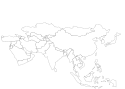
About the Map of Asia
This map of Asia shows 48 countries, from Turkey and the Middle East in the west to Japan in the east and Indonesia in the south. Russia stretches across the whole north of the continent. China and India together are home to more than a third of the world's people, and the Maldives, a chain of coral islands in the Indian Ocean, is the smallest country in Asia.
Tips for Learning the Countries
- Split Asia into parts: the Middle East, Central Asia (Kazakhstan, Uzbekistan, Turkmenistan, Kyrgyzstan and Tajikistan), South Asia, East Asia and Southeast Asia.
- In the Middle East, start with Saudi Arabia, which covers most of the Arabian Peninsula, then go around its coast: Yemen, Oman, the United Arab Emirates, Qatar, Bahrain and Kuwait.
- Southeast Asia mixes mainland and islands. Learn the mainland first (Myanmar, Thailand, Laos, Cambodia and Vietnam), then the islands from the Philippines to Indonesia, with Malaysia on both.
The Countries Players Miss Most
From 7,754 anonymous answers in DodoThinks map quizzes, as of November 2026: the countries on this map that players find least often. Worth a second look when you study.
- 1BhutanOften mistaken for Bangladesh31% right
- 2Timor-LesteOften mistaken for Indonesia42% right
- 3ArmeniaOften mistaken for Azerbaijan45% right
- 4United Arab EmiratesOften mistaken for Saudi Arabia46% right
- 5ThailandOften mistaken for Myanmar46% right
- 6LaosOften mistaken for China46% right
- 7MyanmarOften mistaken for Azerbaijan47% right
- 8VietnamOften mistaken for Myanmar47% right
How to Use These Maps
- Study: print the blank map and label it from memory, then check it against the map with names.
- Flags: the flag map fills every country with its own flag, so flags and places stick together. It also makes a bright poster.
Ready to Test Yourself?
Once you've studied the map, take the click-the-map quiz.
Countries on the Map of Asia
Afghanistan, Armenia, Azerbaijan, Bahrain, Bangladesh, Bhutan, Brunei, Cambodia, China, Georgia, India, Indonesia, Iran, Iraq, Israel, Japan, Jordan, Kazakhstan, Kuwait, Kyrgyzstan, Laos, Lebanon, Malaysia, Maldives, Mongolia, Myanmar, Nepal, North Korea, Oman, Pakistan, Palestine, Philippines, Qatar, Russia, Saudi Arabia, Singapore, South Korea, Sri Lanka, Syria, Tajikistan, Thailand, Timor-Leste, Turkey, Turkmenistan, United Arab Emirates, Uzbekistan, Vietnam, Yemen.
Frequently Asked Questions
Is the printable map of Asia free?+
Yes. Every version of the map of Asia, with all 48 countries, is free to print or download, with no sign-up and no watermark beyond a small credit line.
Which versions can I print?+
Three: a blank outline map to fill in, a map with every name, and a flag map where every country is filled with its own flag and named. Small countries with no room for a label are numbered and listed in a key under the map.
Can I download the map of Asia as an image?+
Yes. Choose a style, then Download: PNG or JPEG for an image, or SVG for a file of Asia that stays sharp at any size, from a worksheet to a wall poster.
How do I save the map as a PDF?+
Choose a style, click "Print / Save as PDF", and in the print dialog pick "Save as PDF" as the destination.
Can I use the map of Asia in the classroom?+
Yes. Print as many blank copies as your class needs: students label the countries from memory and check their work against the map with names. The maps are free for personal and classroom use.