
Printable Map of North America
All 23 countries, free to print or download. Pick a style below.
⬇ Download
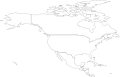
About the Map of North America
North America has 23 countries. Three of them, Canada, the United States and Mexico, cover most of the land. The other 20 are much smaller: the 7 countries of Central America and the 13 island nations of the Caribbean, from Cuba, the largest Caribbean island, to Saint Kitts and Nevis, the smallest country in the Americas. Greenland is a territory of Denmark, so it is not counted as a country.
Tips for Learning the Countries
- Learn Central America from north to south: Guatemala and Belize, then El Salvador and Honduras, Nicaragua, Costa Rica and Panama.
- El Salvador is the only Central American country with no Caribbean coast, and Belize the only one with no Pacific coast.
- In the Caribbean, start with the big islands: Cuba, Jamaica, and Hispaniola, which Haiti and the Dominican Republic share. Then follow the small islands south towards Trinidad and Tobago.
The Countries Players Miss Most
From 2,461 anonymous answers in DodoThinks map quizzes, as of November 2026: the countries on this map that players find least often. Worth a second look when you study.
- 1El SalvadorOften mistaken for Guatemala34% right
- 2NicaraguaOften mistaken for Guatemala34% right
- 3GuatemalaOften mistaken for Honduras37% right
- 4Trinidad and TobagoOften mistaken for Jamaica39% right
- 5HondurasOften mistaken for Nicaragua39% right
- 6Costa RicaOften mistaken for Guatemala41% right
- 7BahamasOften mistaken for Cuba48% right
- 8JamaicaOften mistaken for Cuba52% right
How to Use These Maps
- Study: print the blank map and label it from memory, then check it against the map with names.
- Flags: the flag map fills every country with its own flag, so flags and places stick together. It also makes a bright poster.
Ready to Test Yourself?
Once you've studied the map, take the click-the-map quiz.
Countries on the Map of North America
Antigua and Barbuda, Bahamas, Barbados, Belize, Canada, Costa Rica, Cuba, Dominica, Dominican Republic, El Salvador, Grenada, Guatemala, Haiti, Honduras, Jamaica, Mexico, Nicaragua, Panama, Saint Kitts and Nevis, Saint Lucia, Saint Vincent and the Grenadines, Trinidad and Tobago, United States.
Frequently Asked Questions
Is the printable map of North America free?+
Yes. Every version of the map of North America, with all 23 countries, is free to print or download, with no sign-up and no watermark beyond a small credit line.
Which versions can I print?+
Three: a blank outline map to fill in, a map with every name, and a flag map where every country is filled with its own flag and named. Small countries with no room for a label are numbered and listed in a key under the map.
Can I download the map of North America as an image?+
Yes. Choose a style, then Download: PNG or JPEG for an image, or SVG for a file of North America that stays sharp at any size, from a worksheet to a wall poster.
How do I save the map as a PDF?+
Choose a style, click "Print / Save as PDF", and in the print dialog pick "Save as PDF" as the destination.
Can I use the map of North America in the classroom?+
Yes. Print as many blank copies as your class needs: students label the countries from memory and check their work against the map with names. The maps are free for personal and classroom use.